|
Native American Rock Art: Judaculla Rock
Adapted from ncmarkers.com
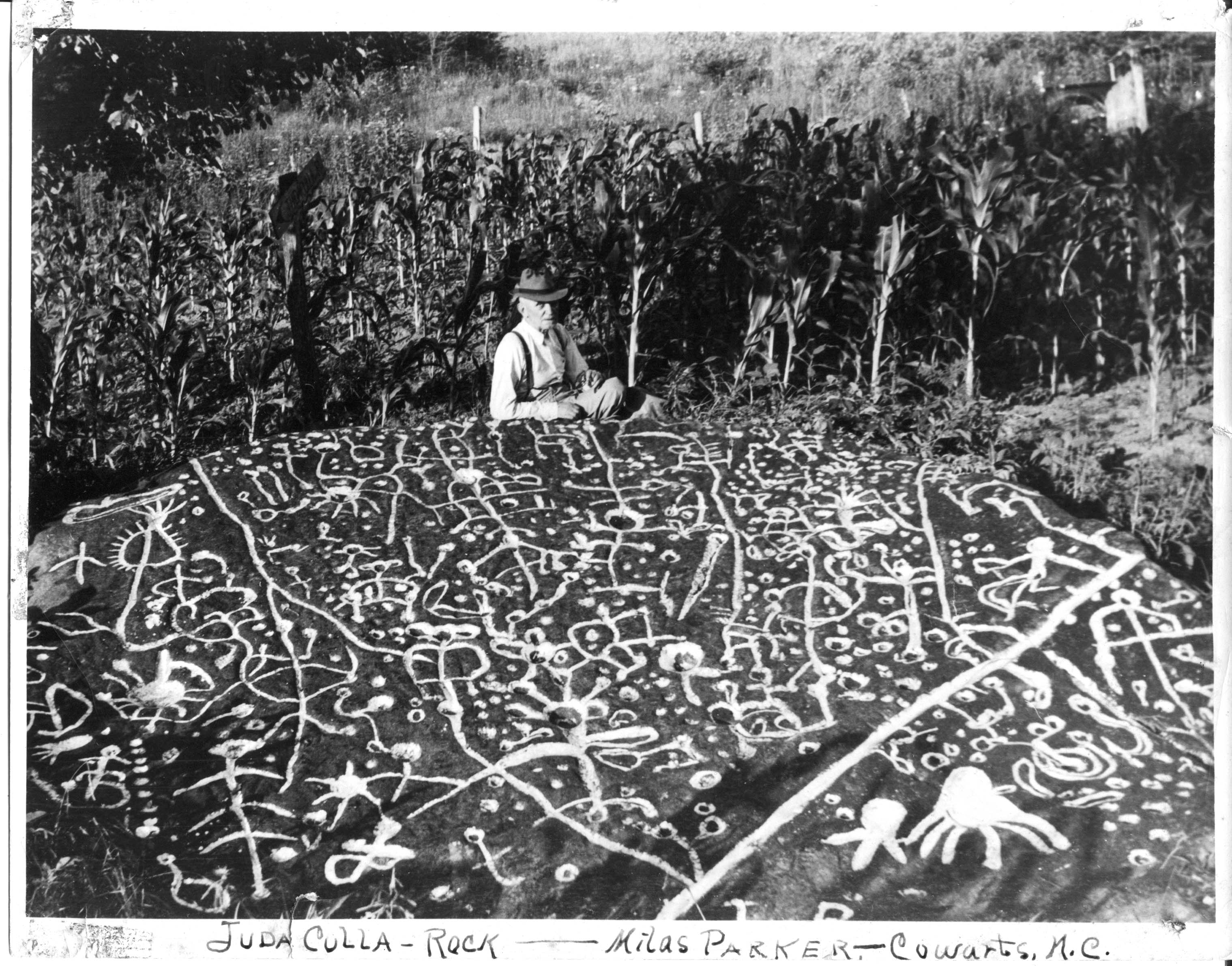
Judaculla Rock is North Carolina’s
best known and largest example of an American Indian petroglyphs site. In the modern and generic sense, it is a public attraction
and a point of interest, and is commonly identified as a boulder covered with ancient and mysterious engravings. It is much
more. Judaculla Rock is one of several petroglyph boulders within a 15 acre area that is an archaeological site of great significance.
Broader still, the Judaculla Rock site is but one landscape component of a prominent Cherokee legend that chronicles the vast
supernatural and physical realm of Judaculla.
| Native American Rock Art: Judaculla Rock |

|
| Cherokee Judaculla Rock |
Judaculla is the anglicized pronunciation of Tsul Kalu, as documented by
the Bureau of American Ethnology’s James Mooney in the late 19th Century. Mooney, along with several other visitors
to Cherokee territory, recorded varying tales of a legendary giant. By all accounts, Judaculla was a human-like giant with
supernatural powers, who traveled between This World and the Underworld. On a 1900 map by Mooney, Judaculla Rock is mapped
along with principal Cherokee towns and other notable major features, suggesting its relative importance to the Cherokee people.
The name of the giant - Tsul Kalu – means “he has them slanting,” being understood as referring to his eyes.
Of his otherworldly powers, the slant-eyed giant primarily was considered to be the Master of all Game Animals. In their daily
lives, the Cherokee included his name in their formulas, rites, and rituals to ensure success in hunting.
The geographic region associated with Judaculla includes at least 12 prominent place-names or features that give testament
to his reign, encompassing an 800 square mile region. Kanuga Town, and a mound that was located there, is the initial setting
for the Judaculla story, and the hometown of his wife, her mother and brother. Judaculla lived atop and within the great Balsam
Mountain Range, more specifically at Tanasee Bald and the Devil’s Courthouse. The Tanasee Bald area was called Judaculla
Old Fields by early settlers and was considered to be both Judaculla’s farm and one of his Underworld entryways.
On the next mountain top over from Tanasee Bald, Judaculla sat upon his great mountain top judgment seat with
a commanding view down upon all of those who may partake in the hunt of his game. The place was later misnamed the Devil’s
Courthouse, due to early American visitor accounts of Judaculla being a type of Devil. Located just below Tanasee Bald and
the Judgment seat, are the ridgetop balds of Judaculla Ridge and Old Fields Ridge, said to be huge fields once farmed by Judaculla.
Looking Glass Rock is a nearby granitic dome mountain, and the place where Judaculla is said to have seen his own reflection.
When wet or icy, the granite cliff faces reflect light and only a giant could stand so tall to see himself at those great
heights.
The glyph origin story tells of Judaculla in chase of rogue hunters, and
he leapt down from his mountaintop fields and landed in the Caney Fork creek bottom lands (a distance of over 10 miles and
3,200 feet). As he landed he stumbled and put out a hand to keep from falling. His hand pressed against a giant boulder to
steady his massive frame. In so doing he left several indentions including an impression of his hand. Then with the with the
nail of his right index finger, he drew a sharp line across the face of the rock that was to remind people that harm would
come to those who crossed it without first going through the appropriate rituals. Shining Rock, is yet another place of reverence
for the Cherokee, and also the general location for petroglyphs. The Cherokee know Shining Rock area as “Where the tracks
are this way.” Here, Judaculla’s children left tracks in the rocks while on their way from Kanuga to their home
at Tanasee Bald. (See Native American and Cherokee Indian: Rock Art, Stone Symbols, Myths,
Legends, and Signs.)
Researchers in the Cherokee Studies program at Western Carolina University recently
have deciphered the term Cullowhee as a shortened and anglicized form of Jutaculla-whee, meaning Judaculla’s Place.
Cullowhee is located six miles northeast of Judaculla Rock. As at Kanuga, a mound once was present at Cullowhee, on what is
now the Western Carolina University campus.
Today the Judaculla Rock is owned by Jackson County,
having been donated in 1959 by the Parker family, very conscientious caretakers who still own the surrounding lands. Since
1959, the one-acre county-owned area around the rock has undergone a variety of improvements that concluded with unintended
negative impacts. In 2005, worsening site conditions led the North Carolina Rock Art Project and Western Carolina University
professors to initiate preservation efforts. In 2007 Jannie Loubser of Stratum Unlimited and soil scientist colleague Douglas
Frink were hired to complete a conservation plan for Judaculla Rock. Loubser’s initial condition assessments found nearly
one-half of the rock had been covered with sediment since the 1920s, most since the 1960s.
Loubser’s
ethnographic, historical, and archaeological work at the site resulted in the most extensive documentation of this cultural
resource to date. He believes petroglyphs on the Judaculla Rock are the most extensive and complicated known to exist not
only in North Carolina but also in the entire region east of the Mississippi River. With a meticulous study of the petroglyphs
formation, Loubser developed the first tangible chronology for the rock. Soapstone quarrying began in the Late Archaic period,
roughly 3,500 years ago. More recent cupules, nested rings, cross-in-circle, and stylized figurative motifs probably date
to somewhere between the Middle Woodland to Late Mississippian periods and perhaps even into the early historic period (late
1700s). Glyph carving was episodic and the chronological placement of these probably falls within the Late Woodland to Late
Mississippian periods—or about 500 A.D. to 1700. Loubser devoted a large section of the Judaculla report to identification
and interpretation. He makes an appealing argument for the rock being a three-dimensional picture map of Judaculla’s
world—a highly stylized scale-model of the surrounding sacred landscape with its mountains, rivers, trees, villages,
and spirit beings.
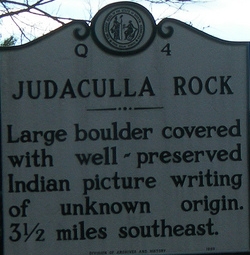
| Judaculla Rock Marker |

|
| Location of Judaculla Rock, NC |
The Cherokee’s post European/American contact story is one of strength
and perseverance. The well documented 1830s Trail of Tears tragedy split the Cherokee into two groups now known as the Cherokee
Nation and Eastern Band of the Cherokee. Even in the theater of intense cultural conflict and displacement, many Cherokee
maintained an intimate relationship with Judaculla Rock. The Eastern Band of the Cherokee has emerged as a principal partner
in efforts to protect, enhance, and celebrate the Judaculla Rock cultural site. Future improvements will include the distinctive
touch and perspective of the Cherokee including interpretation and signage that will be in both English and the Cherokee language.
Both the enduring story of Judaculla, and that of the Cherokee People is one of permanence and fortitude, whose signature
on the mountainous Southern Appalachian landscape continues to stand the test of time.
Related Reading:
References: Information supplied by Scott Ashcraft, Pisgah National Forest
Archaeologist, for publication May 2010; A. S. Ashcraft and D. G. Moore, “Native American Rock Art in Western North
Carolina,” in Collected Papers on the Archaeology of Western North Carolina, edited by D. G. Moore and A. S.
Ashcraft (1998), pp. 59-88; J. H. N. Loubser and Douglas D. Frink, “The Heritage Resource Conservation Plan for Judaculla
Rock,” on file at the Office of County Manager, Jackson County (2008), North Carolina Rock Art Survey.
|

